There was again no meeting for the IOM Photographic Society this week. However the recent excellent if rather cold weather has given opportunity to explore our countryside and to develop an understanding of the landscape and the forces which have helped create it. And the Island offers the geographer and the geologist much to explore and enjoy!
Whilst we have indeed had a colder and drier than usual April, who would think that some 70,000 years ago and until only perhaps 10,000 years ago, the island was an awful lot colder, being covered by an ice sheet some hundreds of feet thick an ice sheet which had advanced and retreated several times? At its peak, the ice sheet stretched over the whole of the island, covering as well all of Scotland, Ireland, most of Wales, and England as far south as the Midlands
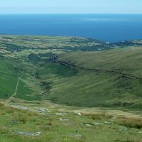
And the evidence is to be found in our valleys and on the Northern Plain. The image of the Laxey Valley, taken from Snaefell, shows a very typical glacial valley the open and wide U- shape is the result of the erosive power of ice gouging a path through the rock, only the small V-shape at its bottom being river erosion since the last Ice Age.
And in its retreat phases (strictly when melting is faster than the advance of the ice front) the glacier was still pushing and depositing vast quantities of rubble at its front. Thus the Northern Plain the triangle of land between Ramsey, Kirk Michael and the Point of Ayre - is composed of layers of deposition again hundreds of feet thick, some either pushed ahead of the glacier or carried along with it, some the alluvial outwash from the streams and rivers resulting from the melting. This material has been carried southwards from as far away as Western Scotland or from the floor of what is now the Irish Sea.
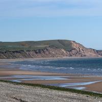
In its last advance, 10-12,000 years ago, the ice front pushed some soft sediments up into a line of hills technically a terminal moraine, which we know today as the Bride Hills and which can be seen in the attached image taken from Ramsey foreshore.
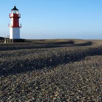
The material deposited on the Northern Plain is soft, not consolidated, so prone to erosion by the power of rivers and particularly, of the sea. So the coast north of Kirk Michael is losing the battle with wave power and storm damage, the soft sands and gravels being quickly eroded and carried away, the gravel and pebbles in turn being deposited further along the coast and now accumulating at the Point of Ayre. There is an interesting display at the MWT Ayres Visitor Centre at Ballaghennie of a variety of rocks and pebbles found on the beach there and which identifies their likely source and youll be amazed to realise the distance they have travelled!
The final meeting of this season for the IOM Photographic Society is on Wednesday 19thMay when the Annual General Meeting will be held. Our meetings are held the St John Ambulance HQ on Glencrutchery Road, starting at 7:00 pm and are open to the public (non-members with a modest entry fee), and all will be given a very warm welcome. Please check our website www.iomps.com and our Facebook page for details of future events and programme updates.
The Isle of Man Photographic Society is supported by the Arts Council
Chris Blyth


